Explore the islandGuide
Port d'Andratx and the Serra de Tramuntana: a west coast guide
Where the yachts end, the mountains begin. How to combine Mallorca's most handsome harbour with the island's UNESCO mountain range, from a short coastal walk to the GR 221.
 Placeholder image
The short answer
Port d'Andratx is a natural harbour on Mallorca's southwest tip where fishing boats still share the water with yachts. It is also the start of the GR 221 dry stone route through the Serra de Tramuntana, a UNESCO World Heritage cultural landscape since 2011. Pair the harbour and Sa Dragonera with the mountain drive to Valldemossa and Sóller.
Key takeaways
- The Serra de Tramuntana was inscribed as a UNESCO World Heritage cultural landscape in 2011.
- The GR 221 long distance path starts at Port d'Andratx; book its mountain refuges through the Consell de Mallorca.
- Boats to the Sa Dragonera Natural Park leave from Sant Elm, just north of Port d'Andratx, mainly from March to October.
- For an easy start, Calvià's four new signposted PR-MA trails (21.6 km in total) opened in July 2026.
- Puig Major is the highest peak but its summit is military; Massanella is the highest you can climb.
On this page
- What is Port d'Andratx like today, beyond the yachts?
- How do you get from Port d'Andratx to Sa Dragonera?
- What makes the Serra de Tramuntana a World Heritage site?
- Which Tramuntana walks suit your level?
- Where should you stay and eat in the western Tramuntana?
- Is the drive from Andratx to Valldemossa and Sóller worth it?
- When is the best time to visit Port d'Andratx and the Tramuntana?
Port d'Andratx is the best base for Mallorca's west: a deep natural harbour with a working fishing quay, a marina and a waterfront of cafés, set right where the Serra de Tramuntana drops into the sea. From here you can take a boat to Sa Dragonera, start the island's great long distance walk, or drive the mountain road north towards Valldemossa and Sóller.
This guide updates the west coast feature from our print guide. The landscape has not changed; several of the addresses have, and we have only kept those we could confirm today.
What is Port d'Andratx like today, beyond the yachts?
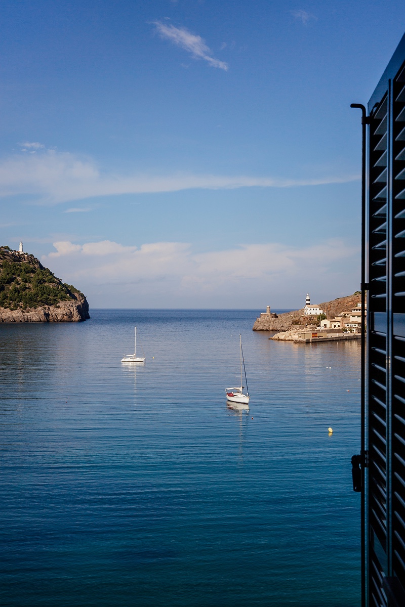
It is still a real harbour. Traditional fishing boats share the port with leisure craft, and the promenade along the water is lined with cafés, restaurants and boutiques. Come in the late afternoon, when the light softens over the hills and the waterfront fills up for an aperitif.
The southwest has a reputation as Mallorca's most glamorous corner, and Port d'Andratx is one of three marinas that earned it, alongside Puerto Portals and Port Adriano further east towards Palma. Puerto Portals is the most polished of the three; Port d'Andratx feels the most like a village. If you are thinking about a home on this coast, our selection of top properties is a good place to start.
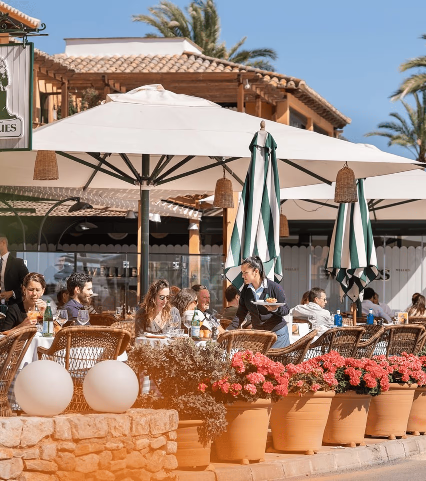
Marina Views, Great Food · Portals Nous
Wellies Restaurant
A long-standing café, restaurant and bar on the marina at Puerto Portals, useful if you stop on the drive between Palma and Andratx.
How do you get from Port d'Andratx to Sa Dragonera?
Drive or take the bus to Sant Elm, the small village just north of Port d'Andratx, and catch an excursion boat from the pier; the crossing to the island takes about 15 minutes. Some operators also run boats directly from Port d'Andratx, and public bus line 100 connects Palma with Sant Elm.
Sa Dragonera has been a natural park since 1995. Boats land at Cala Lledó, where the information centre is, and four signposted paths lead to viewpoints and the island's lighthouses, including the Tramuntana and Llebeig lights. There is no bar and the water in the toilets is not drinkable, so bring water, food and sun protection. Regular crossings run mainly from March to October and depend on the weather, so check times with the operator before you go.
What makes the Serra de Tramuntana a World Heritage site?
UNESCO inscribed the Cultural Landscape of the Serra de Tramuntana in 2011 for what people built in it, not only for its scenery. Over centuries, farmers carved the steep slopes into dry stone terraces, and irrigation channels and cisterns, a system first introduced during the island's Islamic period, made the mountains farmable. The protected area covers more than 30,000 hectares.
The range runs for about 90 kilometres along the northwest of the island, from Sant Elm and Sa Dragonera to the Formentor peninsula. Its highest peak is the Puig Major, at roughly 1,440 metres, but the summit is a military installation and closed to walkers, so the highest summit you can actually climb is the Puig de Massanella. Below the Puig Major lie the two reservoirs of Cúber and Gorg Blau, a favourite stop on the mountain road.
Which Tramuntana walks suit your level?
Pick by time and fitness: a signposted family loop for a half day, a single GR 221 stage for a full day, or several stages linked by mountain refuges for a week. The table sets out the main options from the Andratx end of the range.
| Option | Length | Good for |
|---|---|---|
| PR-MA 4 Font de Sa Cometa (Calvià) | 3.4 km loop | Families and an easy first walk |
| PR-MA 3 Sa Vinya (Galatzó estate) | 6.5 km | Old farm tracks across a public estate |
| Puig de Galatzó summit | Full day | Fit, sure-footed walkers only |
| GR 221 Ruta de Pedra en Sec | Several days, stage by stage | Experienced hikers using the refuges |
Calvià's new signposted trails
In July 2026 the municipality of Calvià opened four new signposted short routes, PR-MA 1 to PR-MA 4, with 21.6 kilometres between them. They run from Peguera to Es Capdellà and across the Galatzó public estate in the foothills of the Tramuntana, which is being restored. The shortest, Font de Sa Cometa, is a 3.4 kilometre family loop.
Puig de Galatzó
The pyramid-shaped Galatzó, at about 1,026 metres, dominates the view inland from Andratx and Calvià. The summit route from the Galatzó estate is the longest and steepest walk on the estate and is not for inexperienced walkers, but the view from the top is among the best on the island.
The GR 221, the Dry Stone Route
The GR 221, or Ruta de Pedra en Sec, begins at Port d'Andratx and crosses the Tramuntana to the north of the island, following old mule tracks and terraced paths. It is walked in stages that start and finish at mountain refuges run by the Consell de Mallorca, including Can Boi in Deià, Muleta near Port de Sóller, Tossals Verds, Son Amer near Lluc and Pont Romà in Pollença. Book beds and meals through the Consell's refuge booking site; route lengths vary between sources because of the many variants, so plan with an up to date map.
Where should you stay and eat in the western Tramuntana?
For a mountain stay near Andratx, Castell Son Claret sits at the foot of the Galatzó near Es Capdellà, about 25 minutes by car from Palma. It is a restored historic estate turned five-star hotel and a member of The Leading Hotels of the World. Its fine dining restaurant, Sa Clastra, holds a Michelin star under chef Jordi Cantó and serves a single tasting menu, "Wind and Memory", that reinterprets Mallorcan cooking. The more relaxed Olivera cooks Mediterranean dishes with produce from the estate's garden.
A correction for readers of our print guide: the two-star restaurant we described at the castle has since left, and Sa Clastra took its place in 2021. For more tables across the island, see our restaurant selection, and for places to stay, our hotel pages.
Is the drive from Andratx to Valldemossa and Sóller worth it?
Yes. The Ma-10 mountain road climbs out of Andratx and follows the coast high above the sea through Estellencs and Banyalbufar, with terraces dropping to the water. Allow most of a day with stops, and drive it in the morning before the tour coaches.
In Valldemossa, visit the Real Cartuja, the former Carthusian monastery where Frédéric Chopin and George Sand spent the winter of 1838 to 1839; one of the cells is now a small Chopin museum. Further on, Sóller sits in a valley of orange and lemon groves. The wooden train from Palma has run since 1912, and a tram links the town with Port de Sóller on the bay.
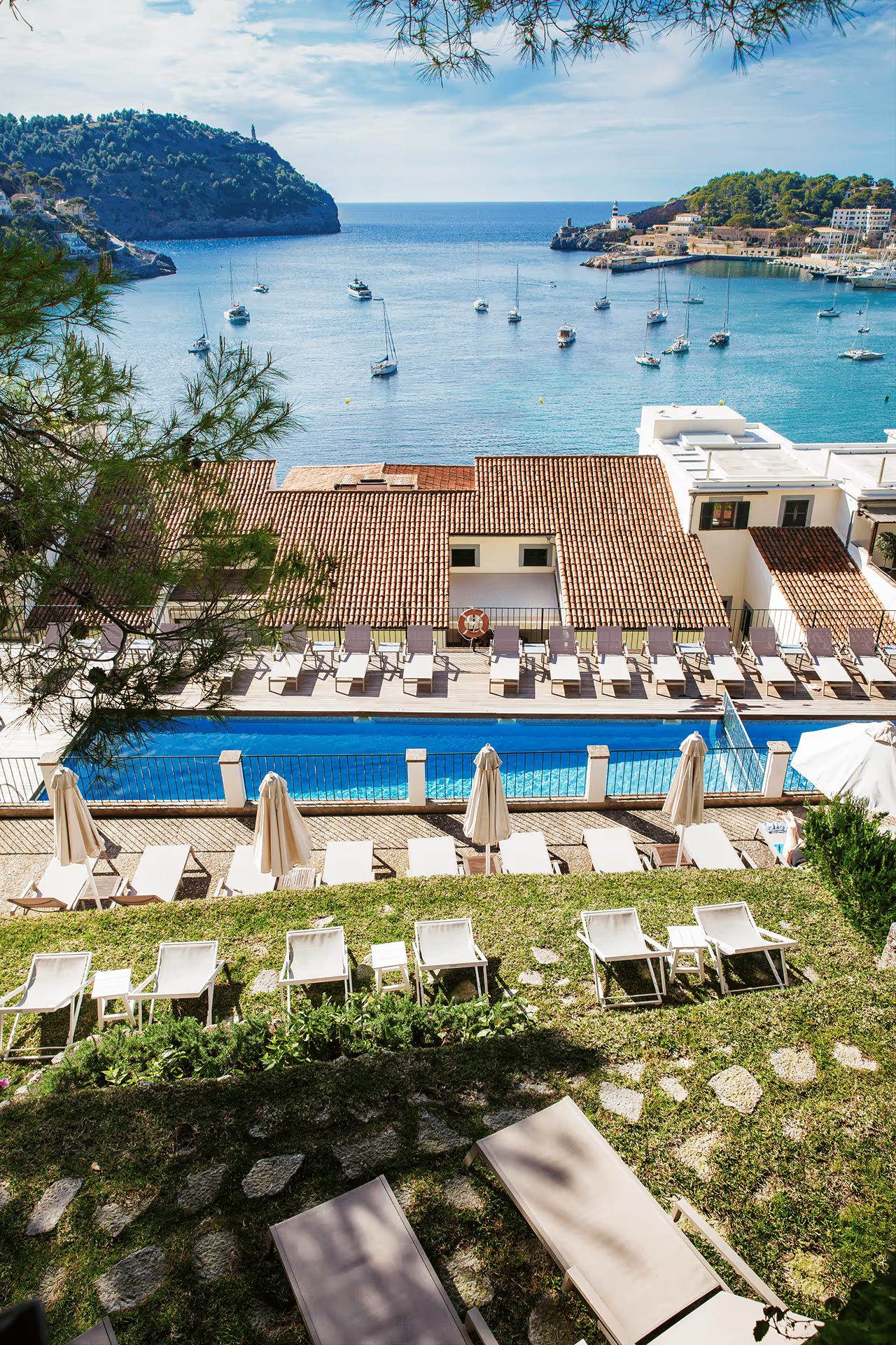
Harbour Views & Sunsets · Hotels
Hotel Espléndido
A seafront hotel on Port de Sóller's promenade, with a spa, on the tram line; a calm base for the northern half of the drive.
Port de Sóller is also a good place to break a longer walk: the Muleta refuge on the GR 221 is close by. For a quieter corner of the island after the mountains, our day in Santanyí covers the southeast, and our guide to golf in Mallorca covers the island's courses.
When is the best time to visit Port d'Andratx and the Tramuntana?
Spring and autumn are best for walking and for the drive; summer is best for the harbour and the sea. In July and August, plan walks for the early morning and spend the afternoon by the water. In winter, refuges, boats and some restaurants run reduced schedules, so check before you go.
Places in this story
Marina Views, Great Food · Portals Nous
Wellies Restaurant
A long-standing café, restaurant and bar on the marina at Puerto Portals, useful if you stop on the drive between Palma and Andratx.
Harbour Views & Sunsets · Hotels
Hotel Espléndido
A seafront hotel on Port de Sóller's promenade, with a spa, on the tram line; a calm base for the northern half of the drive.
Questions readers ask
Where does the GR 221 start?
The GR 221, the Dry Stone Route, starts at Port d'Andratx in the southwest and crosses the Serra de Tramuntana towards Pollença in the north. It is walked in stages between mountain refuges run by the Consell de Mallorca. Lengths vary between sources because of the route's many variants.
How do I get to Sa Dragonera?
Excursion boats leave from the pier at Sant Elm, a short drive from Port d'Andratx, and the crossing takes about 15 minutes. Some operators also sail from Port d'Andratx. Regular crossings run mainly from March to October and depend on the weather, so check times before you go.
Why is the Serra de Tramuntana a UNESCO World Heritage site?
UNESCO inscribed it in 2011 as a cultural landscape. It recognises centuries of farming in difficult terrain: dry stone terraces, and water channels and cisterns that made the steep slopes productive. The protected area covers more than 30,000 hectares along Mallorca's northwest.
What is the highest mountain in Mallorca you can climb?
The Puig Major is the highest peak in Mallorca, at roughly 1,440 metres, but its summit is a military installation and closed to walkers. The highest summit open to hikers is the Puig de Massanella. Both are in the central Tramuntana and need good fitness and a sure foot.
Are there easy walks in the Tramuntana near Andratx?
Yes. In July 2026 Calvià opened four new signposted short routes, PR-MA 1 to 4, covering 21.6 kilometres across the Galatzó public estate and nearby. The 3.4 kilometre Font de Sa Cometa loop is suitable for families.
Sources and checks
- Mallorquissimo print guide
- UNESCO World Heritage Committee decision 35 COM 8B.34
- UNESCO: Cultural Landscape of the Serra de Tramuntana, documents
- Illes Balears tourism: commercial port of Port d'Andratx
- Govern de les Illes Balears: Parc Natural de Sa Dragonera
- Consell de Mallorca: refuge network booking
- Majorca Daily Bulletin: Calvià opens four new hiking trails (July 2026)
- Castell Son Claret
- Michelin Guide: Sa Clastra
- Eat Drink Sleep Mallorca: Sa Clastra opens at Castell Son Claret (2021)
- Tren de Sóller
- Hotel Espléndido
- Lonely Planet: Real Cartuja de Valldemossa
- Wikipedia: Puig de Massanella
About the author